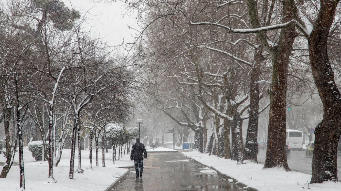
A significant deterioration in the weather is expected starting today, Saturday, with strong thunderstorms in the west, gale-force winds and rain across much of Greece. From Sunday, a marked drop in temperature is forecast, with biting cold and snowfall even at low elevations, sparking debate among meteorologists over how “polar” this bout of severe weather will be.
According to the weekly weather outlook presented by meteorologist and former HNMS (Hellenic National Meteorological Service) director Thodoris Kolydas, Saturday will bring heavy rain and local thunderstorms to Epirus, western Central Greece and western to central Peloponnese, with winds reaching 8 and locally 9 Beaufort, while temperatures will see a brief, slight rise.
Temperature drop and snow from Sunday
On Sunday, according to the forecast, rain will continue in the west, while scattered thunderstorms will occur in the eastern Aegean. Snowfall is expected in mountainous areas and, from the evening, at lower elevations in northeastern Greece. Winds will locally reach 8 Beaufort before gradually easing, while temperatures will drop noticeably—especially in the north—with maximum values of 6 to 8°C.
On Monday, rain or sleet is forecast in the east, with temporary snowfall from elevations of 300 meters and above, before gradual improvement from late afternoon. In the Cyclades, Crete and the Dodecanese, local rain, isolated thunderstorms and snow in the mountains are expected. Northerly winds will blow at 5 to 7 and locally 8 Beaufort. Temperatures will remain low.
Dry northerly winds, frost and gradual improvement
On Tuesday, the weather will improve in most areas, with generally clear conditions, intense cold and frost over the mainland—locally severe in central and northern regions. Local rain will be confined to Crete and the southern Aegean, with light snow in the mountains. On Wednesday, sunshine is expected, winds up to 6 Beaufort, and a further rise in temperatures.
Dispute over snow in Attica
At the same time, a lively debate has emerged among meteorologists over whether the approaching system will bring snow even to low elevations, with Attica at the center of attention. OPEN TV meteorologist Klearchos Marousakis spoke of snowfall even on Aegean islands and left open the possibility of snow in the northern suburbs of Athens.
By contrast, Thodoris Kolydas and Giorgos Tsatrafilias described such scenarios as exaggerated, stressing that it is still too early for firm conclusions regarding Attica and that updated forecast data are awaited. However, according to Tsatrafilias, the first significant cold outbreak of 2026 has “locked in.” The Alpha TV meteorologist noted that on Saturday the main features will be gale-force winds at sea and on land (including Attica) and thunderstorms in the west, with snow in mountainous and low-lying areas of Epirus (from 650 meters). From Sunday to Tuesday, temperatures are expected to plunge by up to 12 degrees, with strong northerlies and snow in mountainous, semi-mountainous and low-lying areas (0–600 meters) in eastern Macedonia, Thrace, Thessaly, Evia, the Sporades, and the northern Aegean islands. For Attica, he mainly forecasts snow in the mountainous areas on Monday, adding that it is still too early to draw safe conclusions for lower elevations.
What the latest assessments say
Klearchos Marousakis stated that from Sunday afternoon to Monday morning snowfall will mainly affect the central mainland, northern Greece and parts of the Peloponnese, before shifting toward the Aegean. As he said, “snow is very likely to reach Attica, and even Crete,” while on Tuesday temperatures in northern Greece could drop to -10 to -12°C.
Action24 meteorologist Olga Papavangeli noted that for now there is no clear picture regarding snowfall in Attica, though Sunday’s temperatures could favor snow in the northern suburbs, especially around Ippokrateios Politeia.
Taking a more cautious tone, meteorologist Giorgos Kanteres estimated that in Attica–Boeotia it will certainly snow in mountainous and semi-mountainous areas, while for Athens “we may see flakes, but it is very difficult for it to settle.”
As experts emphasize, the main weather interest is focused on Monday, with the next 24 hours considered critical for finalizing the forecast, especially for Attica.
Today’s weather
Rainfall and possibly scattered thunderstorms are expected in western and southwestern regions and in the mountains of Crete. At the same time, local rain and possibly scattered thunderstorms are expected until morning in the Dodecanese, around midday in the north and Thessaly, and from afternoon onward in eastern Central Greece, the Peloponnese, and the central and northern Aegean. Snowfall will occur in mountainous mainland areas from midday onward. Atmospheric dust concentrations will be relatively elevated in the south.
Temperatures will range:
- Western Macedonia: -1 to 8°C
- Rest of Macedonia & Thrace: 0 to 14°C
- Thessaly: 3 to 19°C
- Epirus: 5 to 13°C
- Central Greece & Peloponnese: 5 to 18°C
- Ionian Islands: 9 to 14°C
- Northern & Eastern Aegean islands: 11 to 17°C
- Cyclades: 13 to 17°C
- Dodecanese: 14 to 17°C
- Crete: 12 to 19°C
Winds in the Aegean will blow from southwesterly directions at 5 to 7 Beaufort, temporarily and locally up to 8 Beaufort. Winds in the Ionian will blow from westerly directions at 5 to 7 Beaufort, temporarily and locally up to 8 Beaufort.
Attica: Intermittent cloud cover with a chance of brief, local rain after midday. Winds southwesterly 2 to 4 Beaufort, increasing from morning to early evening to 4 to 6 Beaufort. Temperatures in central Athens from 8 to 17°C.
Thessaloniki prefecture: Cloudy, with rain and possibly scattered thunderstorms from midday onward. Southerly winds up to 3 Beaufort. Temperatures from 5 to 14°C.
Weather on Sunday, 11 January
Increased cloudiness with local rain, and scattered thunderstorms in western regions and the eastern Aegean. Snowfall will occur in mountainous areas and, from evening onward, in lower-elevation areas of northeastern Greece.
Winds will blow from westerly directions at 4 to 6 Beaufort, and in the southern Aegean and Crete 7 and temporarily locally 8 Beaufort. From midday in the north, winds will turn northerly at 5 to 7 Beaufort.
Temperatures will drop noticeably in the north, not exceeding 6 to 8°C, while elsewhere they will reach 12 to 14°C and in the Cyclades, Crete and the Dodecanese 15 to 17°C. Frost will occur in central and northern mainland areas.
Weather on Monday, 12 January
In the Ionian, a few temporary clouds until midday. In western Macedonia, Epirus, western Central Greece and western Peloponnese, cloudiness with local rain or sleet and snowfall in mountainous and semi-mountainous areas, then mostly clear from midday. In Thrace, eastern and central Macedonia, northeastern Aegean islands, the Sporades, Thessaly, eastern Central Greece, Evia and eastern Peloponnese, rain or sleet with temporary snowfall in areas above roughly 300 meters. From late afternoon, phenomena will cease in most areas. In the Cyclades, Crete and the Dodecanese, local rain, isolated thunderstorms, and snowfall in the mountains of Crete and the Cyclades.
Winds will blow from northerly directions at 5 to 6 Beaufort and in the seas 7 and locally 8 Beaufort.
Temperatures will drop further nationwide and remain low. Frost will occur over the mainland, locally severe in the north.
Weather on Tuesday, 13 January
In Crete and the southern Aegean, cloudiness with local rain, light snowfall in the mountains and rapid improvement. Elsewhere, generally clear weather with a few local clouds.
Winds northerly 4 to 6 Beaufort, and in the southern Aegean 7 and locally 8 Beaufort, gradually weakening.
Temperatures will rise slightly in terms of maximum values in western, central and northern regions. Frost will occur over the mainland, locally severe in central and northern areas.
Weather on Wednesday, 14 January
Generally clear weather with some local cloudiness in the west from the afternoon.
Winds in the south northwesterly 4 to 5 Beaufort, and variable 2 to 4 Beaufort elsewhere.
Temperatures will rise, though early-morning frost will occur locally over the mainland.
Ask me anything
Explore related questions