Weather – Kolydas: New storm type “P” brings heavy rains on Thursday – Friday, see maps of affected areas
Brief respite today – Rains and severe thunderstorms from Thursday – “Tomorrow’s forecast for the Eastern Aegean and the Dodecanese”
Newsroom
A sudden shift in weather is expected starting this Thursday (October 2), with a “wave” of bad weather gradually affecting much of the country with rains, thunderstorms, and strong winds.
Forecasts also point to a sharp drop in temperatures, along with the first snow of the season in mountainous areas, due to cold air masses moving in from the north.
Kolydas warning: “A widespread storm is coming, tomorrow the forecast for the Eastern Aegean and the Dodecanese”
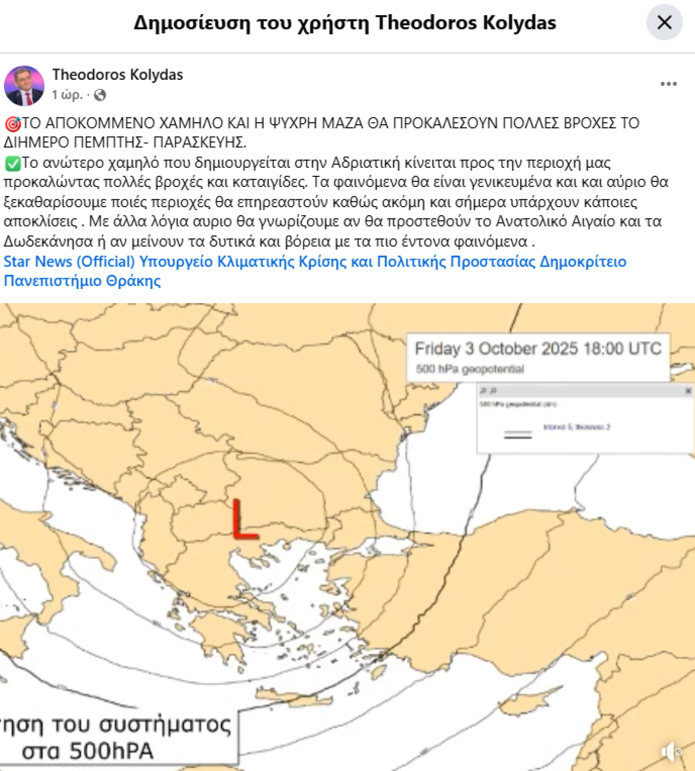
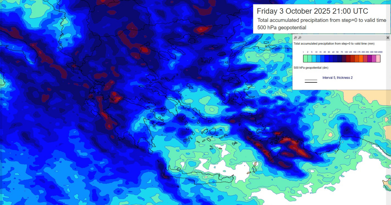
🎯ΤΟ ΑΠΟΚΟΜΜΕΝΟ ΧΑΜΗΛΟ ΚΑΙ Η ΨΥΧΡΗ ΜΑΖΑ ΘΑ ΠΡΟΚΑΛΕΣΟΥΝ ΠΟΛΛΕΣ ΒΡΟΧΕΣ ΤΟ ΔΙΗΜΕΡΟ ΠΕΜΠΤΗΣ- ΠΑΡΑΣΚΕΥΗΣ. ✅Το ανώτερο χαμηλό που δημιουργείται στην Αδριατική κίνειται προς την περιοχή μας προκαλώντας πολλές βροχές και καταιγίδες. Τα φαινόμενα θα είναι γενικευμένα και και αύριο θα… pic.twitter.com/jcVN66MYdW
Meteorologist Theodoros Kolydas updated his weather outlook, noting:
“The upper low forming in the Adriatic is moving toward our region, triggering heavy rains and thunderstorms. The phenomena will be widespread, and tomorrow we will clarify which areas will be affected, as there are still some discrepancies today. In other words, tomorrow we will know whether the Eastern Aegean and the Dodecanese will be added, or if the western and northern regions will remain the ones with the most intense weather.”