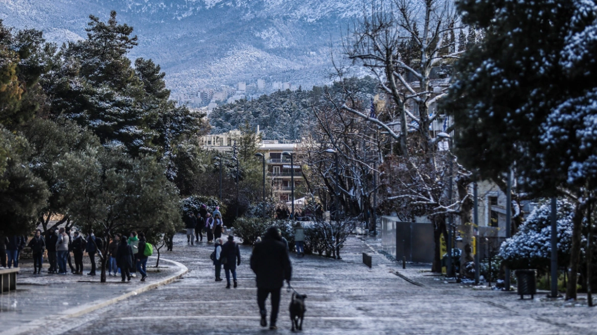
A gradual worsening of the weather is forecast from this afternoon (Sunday, 11-01-26) across Greece, with a severe cold wave, strong northern winds, and snowfall in mountainous, semi-mountainous, and lowland areas, mainly in northern Greece.
Temperatures will remain very low until Wednesday morning (14-01-26).
Frost, locally severe in the north, will occur mainly in the morning and evening hours.
Very strong to gale-force northern winds will blow in certain areas until Monday evening (12-01-26).
Regarding the cold, the Risk Assessment Committee of Civil Protection met at 12:00.
Snowfall is expected:
a. In the mountainous and semi-mountainous areas of mainland Greece and Euboea.
b. From nighttime, in lowland areas of the Eastern Macedonia and Thrace region, in the regional units of Serres and Halkidiki, in the eastern parts of Thessaloniki, as well as on islands of the northern Aegean (Limnos, Lesvos, Chios, Sporades).
c. From early Monday morning, in lowland areas of Euboea (mainly eastern parts) and in the mountainous and semi-mountainous areas of the Cyclades and Crete.
Snowfall will stop before noon on Monday (12-01-26) in the north, and from the afternoon in other areas, except for the mountainous and semi-mountainous areas of Crete, where it will continue until Tuesday morning (13-01-26).
Safety Precautions for Citizens
The Hellenic Civil Protection (civilprotection.gov.gr) of the Ministry of Climate Crisis & Civil Protection has informed all relevant state services, regions, and municipalities to remain on high alert to immediately address the impacts of extreme weather.
Citizens are advised to take particular care and implement self-protection measures against hazards caused by severe weather.
Specifically, in areas expecting heavy rain, storms, or strong winds:
- Secure objects that could be carried by strong winds and cause damage or injury.
- Ensure gutters and downspouts are clear and functioning.
- Avoid crossing streams and rivers, by foot or vehicle, during and several hours after storms and heavy rain. Special attention is needed where roads intersect streams without bridges.
- Avoid outdoor work and activities in coastal and marine areas during severe weather (risk of lightning).
- Take immediate shelter during hailstorms in a building or car and do not leave until the storm passes. Hail can also be dangerous for animals.
- Avoid walking under large trees, hanging signs, or areas where loose objects (e.g., flower pots, broken glass) could fall.
- Follow instructions from local authorities, such as the traffic police.
In areas expecting snow and frost:
If traveling by car:
- Check weather and road conditions.
- Carry snow chains and ensure the fuel tank is full.
- Travel during the day if possible, using main roads.
- Inform family or friends of your route.
- Adjust travel plans to avoid the peak of severe weather.
- Follow instructions from local authorities.
If traveling on foot:
- Wear multiple layers of light clothing instead of a single heavy garment, and wear appropriate footwear to prevent slipping injuries.
- Avoid unnecessary travel during peak weather (heavy snowfall, icy conditions).
Ask me anything
Explore related questions


