
Greece is heading into a new spell of severe winter weather starting tonight, as a cold air mass originating from Ukraine moves southwards, bringing a sharp drop in temperatures, strong winds, and localized snowfall.
According to meteorologist Giorgos Tsatrafyllias, the country will experience a clearly wintry pattern over the coming days, with temperatures falling by up to 10 degrees Celsius, strong northerly winds, and snow in several regions, even at relatively low altitudes.
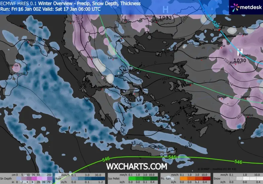
Cold polar air masses are expected to move into Greece within the next 24 hours. However, the phenomena are not expected to be particularly intense, as this air mass is mainly dry and will need to absorb moisture from the Aegean Sea to produce significant rainfall or snowfall.
Weather conditions today will evolve in two phases: mild conditions will prevail until the afternoon, while deterioration will begin in the evening, with weather systems moving from the northeast towards the southwest.
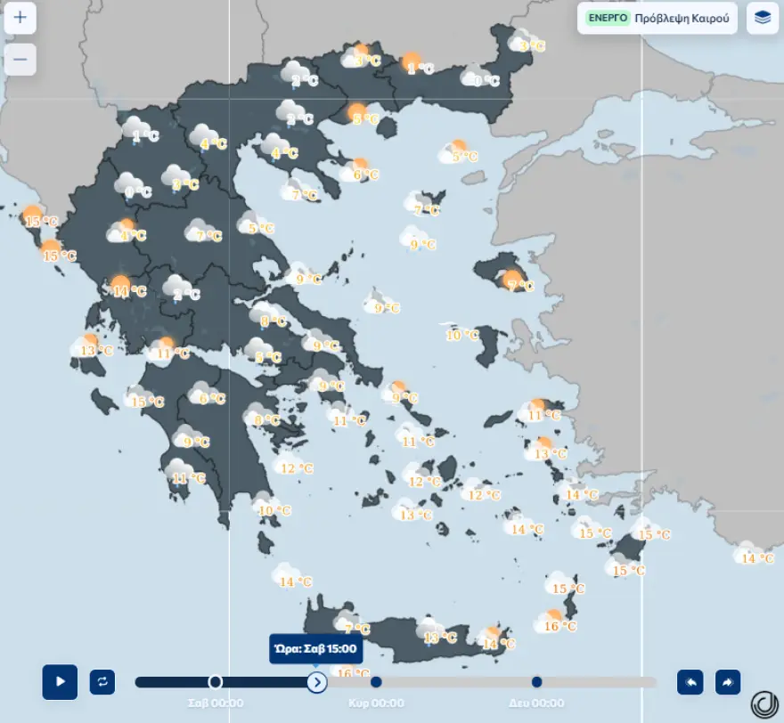
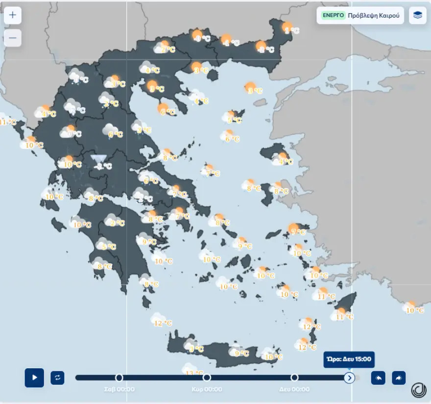
Forecast for Attica
In Attica, temperatures will range between 3°C and 11°C in lowland areas. Strong northerly winds will blow on Saturday, Sunday and Monday, reaching near gale force in the eastern parts of the region. Rain or sleet is expected in low-lying areas, while light snowfall may occur at elevations above 500 meters, without causing accumulation or major disruptions.
Four-Day Cold Spell “Locked In”
In a detailed post, Tsatrafyllias described the situation as a “four-day Ukrainian cold wave,” emphasizing that such weather conditions are typical for the heart of winter.
Key characteristics of the cold outbreak:
- A gradual temperature drop of around 10°C from north to south
- Gale-force northerly winds (8–9 Beaufort) in the Aegean from Saturday to Tuesday
- Strong easterly winds of similar intensity in the Ionian Sea on Monday and Tuesday
- Limited snowfall mainly affecting mountainous areas of Macedonia, Thessaly, eastern Central Greece, Evia, northeastern Peloponnese, the Cyclades, and Crete
- Temporary snow down to 500 meters in central and northern regions
Kallianos: Cold Weather, but Mostly Weak and Selective Snowfall
Meteorologist Giannis Kallianos also warned of a shift to colder, more wintry conditions from Saturday, January 17, through Tuesday, January 20, as cold air masses from Ukraine and the Black Sea move southwestward.
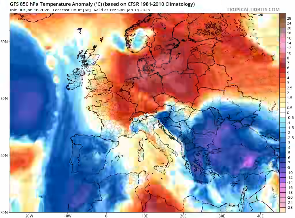
He noted that temperatures will fall by 8–10°C compared to current unusually mild levels, while strong northeastern winds will dominate throughout the four days, reaching 7 to 8 Beaufort in the Aegean and significantly increasing the feeling of cold.
Snowfall will be:
- Localized
- Mostly weak
- Short-lived
Areas most affected include parts of Central and Western Macedonia, Thessaly, Central and Eastern mainland Greece, Evia, the Sporades, eastern and northeastern Peloponnese, the northern and northeastern Aegean, the Cyclades, and Crete.
In lowland and coastal areas, light to moderate rain is expected, while temporary snowfall will occur mainly above 400–500 meters. In parts of northern Greece, snow levels may briefly drop to 100–200 meters, though without significant accumulation.
Looking Ahead
Over the weekend (January 17–18), weather conditions will include rain, snowfall, and strong winds across much of the country, particularly in areas exposed to the Aegean Sea.
- Saturday: Rain mainly in eastern regions; improved weather in the west, but very strong winds nationwide. Snowfall in mountainous and semi-mountainous areas of Crete.
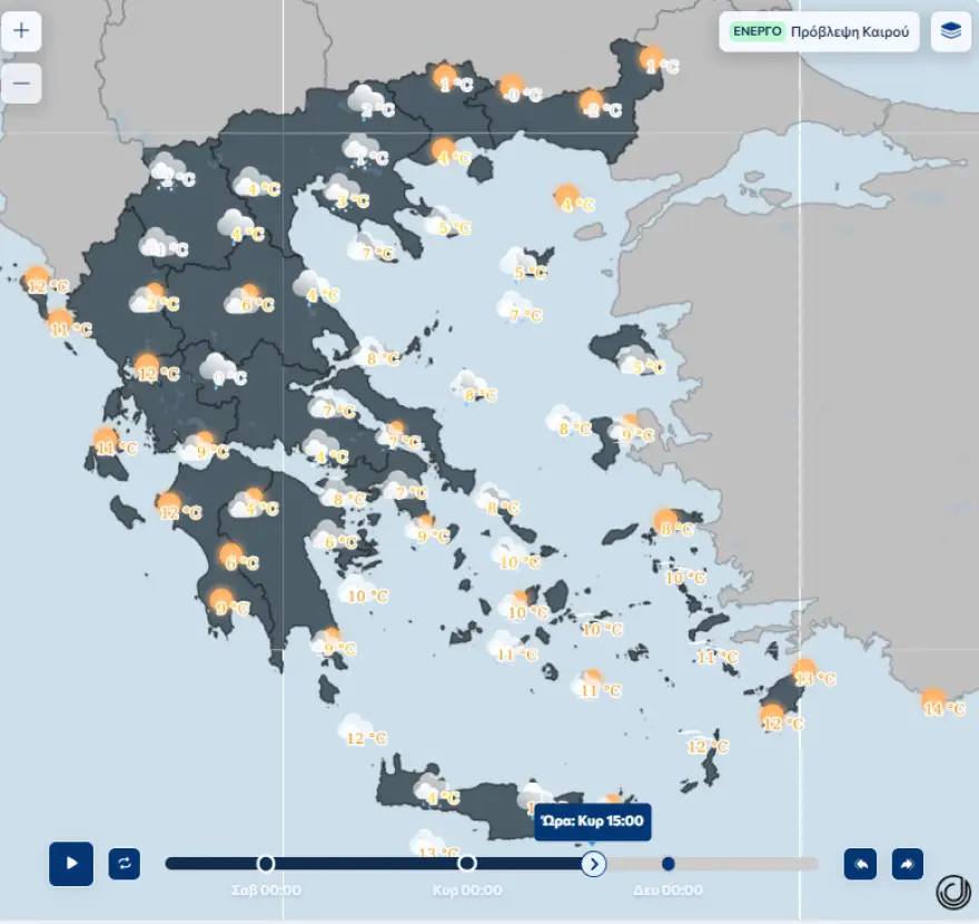
- Sunday: Light rain and sleet at lower elevations, moderate snowfall in mountainous areas, with continued snow in Crete.
- Monday: Persistently cold conditions, increased humidity in eastern and southern regions, and strong easterly winds in western Greece.
No widespread snow accumulation or major disruptions are expected, though caution may be needed in high-altitude areas where snow chains could be required.
Winter is making a brief but noticeable return — cold, windy, and wintry, but without extreme conditions.
Ask me anything
Explore related questions