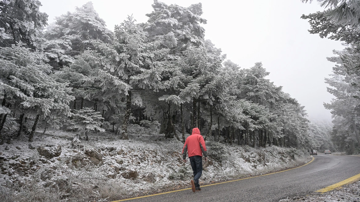
The persistence of intense cold at least until Tuesday, with very low temperatures and frost, along with a significant deterioration of the weather from Tuesday night, bringing heavy rain, thunderstorms and dense snowfall—including snow on Mount Parnitha—is forecast by both the Hellenic National Meteorological Service (EMY) and meteorologists.
Cold and frost until Tuesday
According to Mega TV meteorologist Giannis Kallianos, the intense cold will last at least until Tuesday, with low temperatures across the country. As he noted, until midday Tuesday, local and generally weak snowfall is expected in mountainous areas, while strong frost will occur in the morning.
In Western Macedonia, temperatures may drop as low as -8°C, while in major cities they will range between -5 and -6°C. In central mountainous regions, minimum temperatures will range from -4 to -2°C, with the lowest values recorded on Tuesday morning.
Clash of air masses and severe phenomena
According to Mr. Kallianos, particular interest lies in the weather change from Tuesday afternoon onward, especially during the night. A low-pressure system from the central Mediterranean will transport warm, moist air masses, which will collide with the trapped cold air over the country.
This clash is expected to cause very heavy rain and thunderstorms in central and southern parts of Greece, from Attica southwards. From Tuesday night into Wednesday and throughout Wednesday, dense snowfall is forecast not only in mountainous areas but also in semi-mountainous regions of central and northern Greece.
What to expect in Attica
For Attica, Mr. Kallianos stated that increased rainfall is expected from Tuesday night, while on Wednesday very heavy rain and thunderstorms are forecast, along with very dense snowfall on Mount Parnitha.
The assessment of Thodoris Kolydas
Former EMY director Thodoris Kolydas noted that the very cold and dry air masses affecting the country from the northeast were not capable of producing significant precipitation.
However, from Tuesday night, with the approach of the low-pressure system from the central Mediterranean, higher humidity and better dynamic support are expected, resulting in more intense and noteworthy weather phenomena on Wednesday. He added that EMY has left open the possibility of issuing a related warning, referring in its general forecast to an impending deterioration of the weather.
“Plenty of rain and snow” from Tuesday night
Along the same lines, meteorologist Giorgos Tsatrafyllias estimated that from Tuesday night a low-pressure system will bring abundant rainfall and dense snowfall, mainly in the mountainous parts of the country.
The picture of January and what comes next
Referring to the overall picture of January, meteorologist Nikos Kenteres emphasized that despite three strong cold outbreaks, snowfall has not been particularly heavy, as the air masses were mainly dry.
As he noted, the third cold outbreak will begin to subside from Tuesday, especially on Wednesday and Thursday, with the low-pressure system from the central Mediterranean bringing heavy rain and snow to the mountainous areas of northern and central Greece, as well as locally strong thunderstorms in western, central, eastern and southern regions.
At the same time, before the end of the month, another low-pressure system from the Mediterranean is expected, which will keep January particularly rainy.
Snowfall at low altitudes… and sunshine on the summit of Mount Olympus!
A cold outbreak is currently affecting Greece, with many low-altitude areas experiencing snowfall in northern and central Greece.
However, a particularly impressive—and at first glance paradoxical—phenomenon is being observed: while snow is falling at low and mid-altitudes, even below 500 meters, the highest peaks of Mount Olympus are enjoying clear weather and sunshine.
Today’s weather
In central eastern and southern mainland areas and in Evia, local rain will occur, while light snowfall will affect mainly mountainous and semi-mountainous areas. In Macedonia (mainly central and western parts) and Thessaly, light snowfall is expected locally and intermittently, even in lowland areas. Local rain is also expected in parts of the Cyclades and Crete, while temporary snowfall will occur in the mountains of Crete.
Temperatures will range from -8 to 1°C in Western Macedonia, from -4 to 4°C in the rest of Macedonia, from -8 to 3–4°C in Thrace, from -2 to 8°C in Epirus, from -2 to 4–6°C in central mainland areas, from 3 to 8–10°C in western and southern mainland areas, from 0 to 7°C in the remaining eastern mainland areas, from 4 to 8–10°C in the Ionian Islands, from 0 to 6–7°C in the islands of the northern and northeastern Aegean, and from 4 to 8–11°C in the rest of the Aegean islands and Crete, while in the Dodecanese maximum temperatures will reach 11–13°C.
In the Aegean, northeasterly winds will blow at 5–6 Beaufort and locally 7 Beaufort, strengthening at night. In the Ionian Sea and the Kythira Sea, easterly winds will blow at 5–6 Beaufort, gradually increasing to 7–8 Beaufort and locally 9 Beaufort in the evening.
In Attica and the city of Athens, cloudiness is expected with a few light showers, mainly in the northern and western parts of the prefecture. Light snowfall will occur intermittently in mountainous areas (mainly Parnitha and Kithairon) and locally in semi-mountainous areas. Winds will be northeasterly at 5–6 Beaufort and possibly locally 7 Beaufort in eastern areas. Temperatures will range from 3 to 6–7°C, but in the north they will be 2–3 degrees lower.
In Thessaloniki, until the morning, cloudiness with light snowfall is expected in mountainous and semi-mountainous areas, as well as in low-altitude areas. In coastal areas, sleet and possibly brief light snowfall are expected. The phenomena will quickly cease and sunshine will prevail. Winds will be variable at 2–3 Beaufort. Temperatures will range from 1 to 4–5°C, but in areas around the city they will be 2–3 degrees lower.
Weather on Tuesday, 20-01-2026
In southern parts of Central Macedonia, Thessaly, the Sporades, the islands of the northern Aegean, Evia, eastern Central Greece, the Peloponnese, the Ionian Sea, the Cyclades and Crete, increased cloudiness with local rain is expected, and in the north rain or sleet. In the evening, the phenomena will spread to the rest of the mainland except eastern Macedonia and Thrace. Snowfall will occur in mountainous and semi-mountainous mainland areas, as well as in the mountains of Evia and Crete. At night, the phenomena will intensify in western areas. Elsewhere, thin clouds will gradually thicken.
Winds will be easterly to northeasterly: 6–8 Beaufort in the west and locally 9 Beaufort in the southwest; 5–6 Beaufort in the east and locally 7 Beaufort in the Aegean.
Temperatures will not change significantly. In northern mainland areas they will reach 7–8°C, in central and southern mainland areas 10–12°C, in island regions and western mainland areas 11–13°C, and locally in Crete, the Cyclades and the Dodecanese up to 15–16°C. Frost will occur in the morning and evening in mainland areas, locally strong in the north.
Weather on Wednesday, 21-01-2026
Weather deterioration with increased cloudiness and local rain across the country. Scattered thunderstorms will occur in the Ionian Sea, mainly in marine and coastal areas of western, central and southern mainland Greece, gradually spreading to the Cyclades, Crete, the eastern Aegean islands and the Dodecanese. Snowfall will occur in mountainous and semi-mountainous mainland areas, expected to be heavier in central and northern regions.
Winds in the west will be easterly to southeasterly at 6–8 Beaufort and locally 9 Beaufort in the Ionian in the morning, gradually weakening. In the east, southeasterly winds at 6–8 Beaufort are expected, and from the afternoon locally 9 Beaufort in the Aegean.
Temperatures will rise slightly in the south, but frost will occur in the morning and evening in northern mainland areas.
Weather on Thursday, 22-01-2026
In the west, the Cyclades, Crete, the Dodecanese and the eastern Aegean islands, increased cloudiness with rain and scattered thunderstorms. In other areas, a few clouds temporarily increasing with local rain. Snowfall will occur in mountainous areas of central and northern mainland Greece.
Winds will be southerly to southwesterly at 4–6 Beaufort, while in the morning in the Dodecanese southeasterly winds at 6–8 Beaufort will prevail briefly, and in the northern Aegean northerly winds at 4–6 Beaufort.
Temperatures will rise slightly in northern and central mainland areas.
Weather on Friday, 23-01-2026
In the west and the southern and eastern Aegean, increased cloudiness with rain and scattered thunderstorms. In other areas, a few clouds temporarily increasing with local rain, mainly in central and southern regions. Snowfall will occur in mountainous areas of northern mainland Greece.
Winds will be southerly to southwesterly at 4–5 Beaufort and locally up to 6 Beaufort.
Temperatures will rise slightly.
Ask me anything
Explore related questions